According to the map diagram where the paths have been sketched out, the routes begin at the points that correspond to the numbers, while the duration of the journey refers to the time for a one-way trip, that is to go, but not to return.
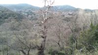
1) From the main square to the Saint John Water Fountain (past the Karalis Mill) From the village square (point 1), we pass the school (which is half ruined), then continue to the little church of Saint Nicholas (Agios Nikolaos) next to the cemetery. We descend to the first watermill of the village, the Karalis mill, pass over the arched bridge, and ascend to the water fountain of Saint John (Agios Yanni or Eh Yanni) with its cool drinking water. (The fountain needs some work.) Lift up your head, and you can see the tallest tree in Velimachi--and maybe in the region! The shrine that gave the fountain its name is a bit higher up, toward the main street. (The route: easy, duration 20-30 minutes.)

2) From Tsoureika to the church of Saint Marina From the road to Tsoureika (at Kasaris), we walk down the path and proceed alongside the river, listening to its water, next to the walnut fields. Across the way, we come to the little church of Saint (Agia) Marina on the main road to Kontovazaina, close to point 5. (The route: easy, duration 20-30 minutes.)
3) From Goumenos water fountain in Aposkia to the fulling mill From the fountain of Goumenos in Aposkia (point 3), we take the path that descends to the village water mill by the river. If we want, we can continue and go out on the opposite side of the road, toward Soudeli. (The route: easy, duration 15-20 minutes.)
4) From the school of Soudelis and church of Saint Barbara to the Saint John water fountain (past the Dai mill) Across from the recently renovated school of the Soudeli-Aposkia Association, we walk down the path toward the little church of Saint Barbara (Agia Varvara). Arriving at the 2nd watermill of the village, the Dai mill, we continue and come out across from the little church of Saint (Agia) Marina near point 5. (The route: easy, duration 30-35 minutes.)

5) From Aposkia and Saint Marina past the church of the Prophet Elias to Kontovazaina Just beyond the little church of Saint (Agia) Marina (point 5), we climb up the road toward the church of the Prophet Elias, heading east toward the area of Boliana, and we come out above Kontovazaina. This is the route that connects the two villages and the markets where students from Velimachi went to the junior high school when they did not have one in their village. (The route: difficult, duration 2-2.5 hours.)
6) From Aposkia to the church of the Holy Ascension and the black fountain (via Kost. Aposkiti Street) From the little bridge of Aposkia (point 6) we walk down Kost. Aposkiti Street. At the top of Mount Aphrodisio we come across the church of the Holy Ascension (Agia Analipsi), while the path goes on to the black fountain (mavri vrysi), with its history described in the book "Velimachi of Arcadia" by G. Christopoulos, page 77. It is a very beautiful route, beloved by Velimachi residents, who used to bake and drink during celebrations up at the church of the Holy Ascension. (The route: moderate, duration 1-1.5 hours, or by car.)
7) From the intersection at Stavros to the church of the Virgin Mary At Stavros we can go up (point 7) to the church of the Virgin Mary (Panagia), where the icon of the Virgin Mary (Panagia) Notenon and the old monastery used to be (see "Velimachi of Arcadia" by G. Christopoulos, page 337). The view from this spot is very beautiful, overlooking Velimachi from the south side and the villages of Ilia (Elis) in the distance. (The route: easy, duration 15-20 minutes, or by car.)
8) From the intersection at Stavros to Koroni and the church of the Saints Theodore At Stavros, at the junction with the road to Koroni, where the road goes toward Voutsis, we go up to the right, heading north to the little church of the Saints Theodore (Agii Theodori) and the Paschali water fountain, where the locals used to take breaks from their agricultural labor. If we wish, we can return on this flat route, circling back to Stavros. (The route: easy, duration 50-60 minutes.)
9) From Velimachi past a sports center to the church of Saint Paraskevi and Kardaritsi Velimachites' beloved afternoon walk to the neighboring village of Kardaritsi. We can go to the little church of Saint (Agia) Paraskevi and on the way back take the perimeter road of Kardaritsi through the village square. (The route: fairly easy, duration 30-35 minutes.)
10) From a fountain in Stergianeika by the Artsina (Arsin) River to Soudeli From the fountain in Stergianeika we ascend to the northeast toward the springs of the Arsin River, near the small stone basins where the villagers of Stergianeika used to bathe. Then descending alongside the river, we go to the edge of Soudeli. (The route: moderate, duration 1-1.5 hours.)
11) **From Velimachi, a fountain in Stergianeika, toward Sera, Damour lakes, Agia Analipsi ** From the fountain in Stergianeika we climb toward the region of Sera (on the way to Seires), we pass the boats (the Daour lakes) and then head to the old castle, climbing up the ridge to the church of the Holy Ascension (Agia Analipsi). (The route: quite difficult, duration 1.5-2 hours.)
12) From Velimachi, a fountain in Stergianeika, and Trikokia toward Paralogitiko and Tripotama Ascending from the fountain in Stergianeika, we go left toward Trikokia on the hill of Vlachos to Kotroni and walk straight to Paralogitiko. There, after the ravines, we have a view of Tripotama, where the Velimachites used to go for commercial business and bazaars. (The route: difficult, duration 2-2.5 hours.)
Happy trails and good progress amidst the natural beauty that holds the whole history of the area!
P. S. We want to thank the Velimachites Vasilis Thomas, Nikos (Kousonikos) and Dina Karavasili, Charalampos (Babis) Daskalopoulos, and Christos Christopoulos for the valuable instructions they gave us, mainly regarding the major routes to Sera, the church of the Holy Ascension (from Daou of the lakes), Kontovazaina, and Tripotama. For more about trails and routes, email Konstantinos Vas. Thomas at kostasvthomas@gmail.com.


