EG Mobile

Info

Map Size: Small Medium Large    Cluster    Map Kind:
200 km
Powered by Leaflet — Map data © Twinnet, GR

Distances (up to 10 km) for Saint Paraskevi  Full Map

Show 25 to 36 from 71
Cyclades - Serifos - Marsos
Settlement
5.2km NNE
Marsos
(Settlement)
KIKLADES, Serifos, SERIFOS
Cyclades - Serifos - Pirgos - Threshing Fllor
Traditional Construction
5.3km S
Threshing Floor
(Traditional Construction)
KIKLADES, Serifos, SERIFOS
Cyclades - Serifos - Pirgos
District
5.3km S
Pyrgos (3)
(District)
KIKLADES, Serifos, SERIFOS
Cyclades - Serifos - Pirgos - Saint Nikolaos
Church
5.4km S
KIKLADES, Serifos, SERIFOS
Cyclades - Serifos - Kallitsos - Saint Konstantinos
Church
5.5km E
KIKLADES, Serifos, SERIFOS
Cyclades Serifos Kerees view
Nice View
5.6km ESE
Antennas - View
(Nice View)
KIKLADES, Serifos, SERIFOS
Cyclades - Serifos - Platis Gialos - Saint Apostles
Church
5.6km NE
KIKLADES, Serifos, SERIFOS
Cyclades - Serifos - Platis Gialos - Small Livadi
Beach
5.7km NE
KIKLADES, Serifos, SERIFOS
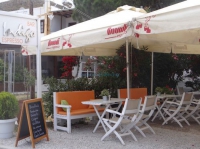
Restaurant
5.7km NE
Nikoulias
(Restaurant)
KIKLADES, Serifos, SERIFOS
Cyclades - Serifos - Saint Athanassios
Church
5.8km SSW
KIKLADES, Serifos, SERIFOS
Cyclades Serifos Kerees view
Nice View
5.8km SE
Antennas - View
(Nice View)
KIKLADES, Serifos, SERIFOS


My Trip
0.3706 15.84MB