EG Mobile

Info

Map Size: Small Medium Large    Cluster    Map Kind:
200 km
Powered by Leaflet — Map data © Twinnet, GR

Distances (up to 10 km) for Church of the Annunciation   Full Map

Show 193 to 204 from 223
Xiropigado
Village
9.2km NNW
Xiropigado (7)
(Village)
ARKADIA, NORTH KINURIA, Municipal Division
Rooms to let
9.2km NNW
Evita
(Rooms to let)
ARKADIA, NORTH KINURIA, Municipal Division
Rooms to let
9.3km NNW
Oniro
(Rooms to let)
ARKADIA, NORTH KINURIA, Municipal Division
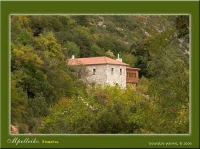
Loukous Monastery
Monastery
9.3km W
ARKADIA, NORTH KINURIA, Municipal Division
Ruins of Water Mill of Loukous Monastery
Windmill Watermill
9.3km W
Loukous Monastery Watermill
(Windmill Watermill)
ARKADIA, NORTH KINURIA, Municipal Division


My Trip
After signing-up the contents of your Trips will be displayed here.
1.3867 15.9MB